


Updated 28 September 2026 · Travo.ng
Quick answer
For live conditions on the Kasoa–Mallam road (the Accra–Cape Coast highway, N1) right now, check a live traffic map such as Google Maps or Waze just before you leave. Then check the latest local radio and news reports for accidents or road works. In 2026 the main causes of delay are potholes around Mallam Junction and flooding at Atala/SCC when it rains. A June 2026 report said these had stretched a 45-minute to 1-hour Kasoa–Accra trip to nearly three hours. In an emergency in Ghana, dial 112, or 191 for the police.
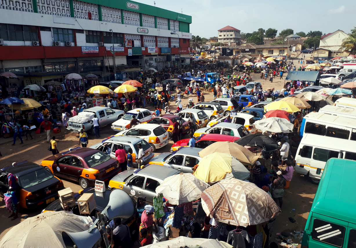
The Kasoa–Mallam stretch is one of Ghana’s busiest commuter corridors. Every weekday, workers from Kasoa, Buduburam, Weija and Gbawe travel into Accra through Mallam and Kaneshie. Buses heading west to Winneba, Cape Coast and Takoradi share the same road. This page doesn’t give minute-by-minute live updates. It explains where and why the road jams, how to get reliable live information and how to travel more safely, with dated reports so you can judge how current each point is.
Current traffic conditions: Kaneshie to Kasoa
The Kasoa–Mallam road is part of Ghana’s N1 highway, the coastal trunk road that runs about 540 km from Elubo on the Côte d’Ivoire border to Aflao on the Togo border. Heading west out of Accra, the N1 passes Kaneshie and Mallam, crosses into the Central Region beyond Ngleshi-Amanfro, and continues through Kasoa and Winneba towards Cape Coast.
| Hotspot | What usually causes delays | Latest dated report |
|---|---|---|
| Mallam Junction | Deep potholes and damaged road surface slow all lanes | June 2026: commute described as nearly 3 hours instead of 45–60 minutes |
| Atala / SCC area | Flooding and siltation after heavy rain | June 2026 (MyJoyOnline); earlier flood gridlock reported by Ghanaian Times |
| Kasoa tollbooth to Kasoa Amanfrom | Lane closures for road works; diversions onto the opposite carriageway | July 2024: queue from the tollbooth to Amanfrom, road blocked for 3+ hours |
| Kasoa to Winneba | Dualisation and expansion works on the coastal highway | Nov 2025: government target of June 2026 completion for Kasoa–Winneba |
Sources: MyJoyOnline (22 Jun 2026; 25 Nov 2025), GhanaWeb (3 Jul 2024), Ghanaian Times. Conditions change daily. Always check a live map before you set off.
One Ghanaian Times report on a rain-related gridlock describes a commuter who left the office at 7:00 p.m. and got home at 11:20 p.m. That’s more than four hours for about 15 km. Others were stranded overnight. It shows how quickly the corridor can lock up when flooding meets an already battered road.
Causes of traffic delays on the Accra–Cape Coast highway
- Poor road surface: potholes at Mallam Junction force vehicles to slow and swerve. Drivers’ representatives say this also raises repair costs for tyres and suspension. A June 2026 report mentions a motorcycle crash on the stretch.
- Flooding: heavy rain floods low sections of the Mallam–Kasoa road, especially around Atala and SCC, and leaves silt behind.
- Road works and expansion: the government has admitted it “made a mistake” by working on the main carriageway and the expansion at the same time, which added to delays. The Kasoa–Winneba section was due for completion in June 2026. We couldn’t confirm in September 2026 whether that target was met.
- Sheer volume: commuter trotros, taxis, private cars and long-distance buses all use one corridor, with frequent stops at junctions and lorry stations.
- Crashes and breakdowns: a single broken-down truck or collision can back traffic up for kilometres, because diversions are limited.
How to get live traffic news today
- Live traffic maps: open Google Maps or Waze and enter your route (for example Kasoa to Kaneshie). Red and dark-red segments show slow traffic. Waze users also report crashes, police and hazards in real time.
- Local radio and news sites: Accra stations and news sites such as MyJoyOnline, GhanaWeb and Adom report major gridlocks, floods and road closures during the day.
- Official channels: the Ghana Police Service’s Motor Traffic and Transport Department (MTTD) manages crash scenes and diversions. The police general enquiry lines listed on the Ghana Police Service contact page are +233 302 773906 and +233 302 787373.
- Weather alerts: watch Ghana Meteorological Agency (GMet) rain warnings. Flooding is a major cause of gridlock on this road.
- Ask your driver or station: trotro and long-distance drivers often know about blockages before they reach the news.
Benefits of real-time traffic information
- Time saved: choosing when to leave, or delaying by 30 minutes, can make a bigger difference than the route you pick.
- Safety: knowing about a crash or flood ahead helps you avoid getting stuck on a dangerous stretch after dark.
- Lower costs: less idling means less fuel and less wear on your car.
- Better planning: if you’re catching a bus to Nigeria or a flight from Kotoka, live information tells you when to leave.
Tips for safer travel on the Kasoa–Mallam road
- Leave early in the morning or after the evening peak where you can.
- Don’t drive through flooded sections. The depth and the potholes underneath are hard to judge.
- Keep a safe distance behind trucks and trotros, which stop suddenly to load and drop passengers.
- On a motorbike, slow down around Mallam Junction, where the surface is badly damaged.
- Carry water, a charged phone and a power bank in case you’re stuck for hours.
- Save Ghana’s emergency numbers: 112 (general), 191 (police), 193 (ambulance) and 192 (fire).
Travelling between Ghana and Nigeria?
Many Nigerians use this corridor to reach Kasoa and Accra, or to head west towards Cape Coast and Takoradi. If you’re planning the full trip, see our guides to the bus to Ghana from Lagos, Lagos to Ghana by road and how much Nigeria to Ghana costs by road. For goods, read about shipping from Nigeria to Ghana.
Planning a Lagos–Accra trip?
Book cross-border bus travel or a private driver on Travo and see the price before you confirm. Our team can help you plan around traffic and border timings.
Frequently asked questions
Is there traffic on the Kasoa–Mallam road today?
Traffic changes by the hour, so check Google Maps or Waze just before you leave. In 2026 the regular trouble spots are Mallam Junction (potholes) and Atala/SCC (flooding after rain).
How long does it take from Kasoa to Accra?
A June 2026 report said a trip that used to take 45 minutes to an hour had become nearly three hours at peak times because of potholes at Mallam Junction. Off-peak trips are much faster.
Why is the Kasoa–Accra road always congested?
A heavy commuter load, a damaged road surface, flooding in the rainy season, and road works on the coastal highway expansion all add up. The government has admitted that working on the main carriageway and the expansion at the same time added to delays.
When will the Kasoa–Winneba road be completed?
In November 2025, Ghana’s Roads and Highways Minister said the contractor expected to finish the Kasoa–Winneba section by June 2026. We couldn’t confirm completion as of September 2026.
Who do I call after an accident on the Accra–Cape Coast highway?
Dial 112 for emergencies, or 191 for the police, 193 for an ambulance and 192 for the fire service. The police MTTD handles crash scenes and traffic control.
Which road is the Kasoa–Mallam road?
It’s part of the N1, Ghana’s coastal highway from Elubo to Aflao, also known as the Accra–Cape Coast road on this stretch.
Related guides
- Live traffic news for the Accra–Tema Motorway
- Live traffic news for Nyanya–Mararaba Expressway
- Transport costs from Nigeria to Ghana
- Bus to Ghana from Lagos
Sources: MyJoyOnline, “Potholes at Mallam Junction turn Kasoa-Accra commute into three-hour ordeal” (22 Jun 2026) and “Kasoa–Winneba highway set for June 2026 completion” (25 Nov 2025); GhanaWeb (3 Jul 2024); Ghanaian Times (Kaneshie–Kasoa gridlock report); Wikipedia, N1 road (Ghana) and List of emergency telephone numbers; Ghana Police Service contact page (police.gov.gh). This page is a guide, not a live feed. Fares and prices change often — confirm before you travel or pay.
