
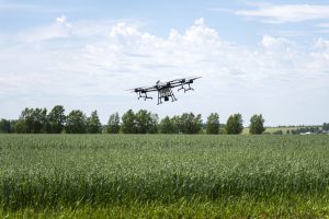
Small and Large Drones in Lagos: Choosing Survey, Inspection and Cargo Enquiries
Choosing between a small drone and a large drone starts with the task and the result you need. Aerial photographs, a measured…
October 19, 2026Explore professional drone services across Nigeria and Africa, including aerial photography, videography, surveying, mapping, inspections, agricultural monitoring, security surveillance, infrastructure assessments, and commercial drone operations. Discover how drone technology is transforming industries such as construction, real estate, energy, agriculture, logistics, mining, and environmental management through efficient data collection, enhanced safety, and cost-effective aerial solutions.
Put drones to work across Nigeria — aerial survey, mapping, inspection and delivery for businesses and projects.
Site surveys and mapping from above.
Inspect sites, assets and infrastructure.
High-resolution photos and video.
Fast delivery where access is hard.
Actionable mapping and survey data.
Trained, compliant operators.
Practical guides, service pages and updates across Drone Services.
Choosing between a small drone and a large drone starts with the task and the result you need. Aerial photographs, a measured…
October 19, 2026
Quick answer: Choose the inspection method for the defect or decision you need to assess. Visual mapping, thermal inspection, gas sensing, ground…
October 15, 2026
Quick answer: Mine monitoring should connect repeat observations to a defined decision and responsible specialist. Drone mapping can document visible changes and…
October 15, 2026
Thermal drones can support search and rescue by giving trained responders an aerial view and helping identify heat contrasts that deserve closer…
October 13, 2026
Before investing heavily in land with potential mineral deposits, separate three questions: what rights are available, what the technical evidence proves, and…
October 13, 2026
A mineral exploration survey cost depends on the question, site conditions and evidence required. A desktop review, aerial map, drone magnetometer mission,…
October 13, 2026 The fastest responsible way to evaluate a mining concession in Nigeria is to remove the largest uncertainties in stages. Start with title…
October 13, 2026
To know whether there are valuable minerals under your land, you need evidence from a qualified geological investigation. Rock colour, a quartz…
October 13, 2026 If you are looking for a drone survey company in Nigeria or Ghana, the most useful starting point is the decision your…
October 13, 2026
Searching for a driving school near me is usually the first step for someone who wants to learn how to drive safely,…
September 18, 2026
Oil palm plantation mapping is becoming increasingly useful for plantation owners, agricultural investors, field managers, and organisations that need a clear picture…
August 24, 2026
Good irrigation starts long before pipes, pumps, sprinklers, or drip lines arrive on a farm. The first step is understanding the land,…
August 24, 2026About Drone Services on Travo.ng.
Explore more of what Travo covers.
Travo connects you with vetted providers across Nigeria. Tell us what you need and we’ll take it from there.
