


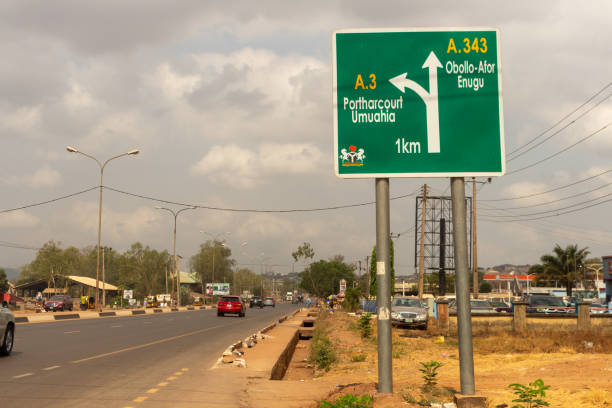
Road maps help drivers, travellers and businesses understand routes between cities, towns and major destinations. Although smartphones have made digital navigation easier, knowing the main roads and routes in Nigeria is still useful when planning journeys, deliveries and interstate trips.
Why Road Maps Are Useful
A road map can help you understand the distance between locations, identify major highways and plan alternative routes when traffic or road conditions cause delays.
This is particularly useful for:
- Interstate travel
- Courier and delivery operations
- Moving goods between cities
- Business trips
- Family journeys
- Airport transfers
- Relocation
Major Road Routes in Nigeria
Nigeria has several important highways connecting major commercial centres.
Examples include routes linking Lagos and Ibadan, Lagos and Benin City, Abuja and Kaduna, Abuja and Kano, and Port Harcourt and Aba.
The best route can change depending on traffic, construction, weather and the final destination, so travellers should consider current road conditions before starting a long journey.
Road Maps and Long-Distance Travel
For interstate journeys, don’t plan your trip based on distance alone. Travel time can be affected by traffic, checkpoints, road repairs, accidents and weather.
A journey that appears straightforward on a map may take significantly longer in real conditions.
It’s therefore useful to allow extra time, especially when travelling for flights, meetings or scheduled events.
Using Road Maps for Business Logistics
Businesses can use road maps to plan delivery routes, vehicle movements and transport schedules.
For example, a company sending goods from Lagos to another state needs to consider the pickup location, delivery destination, vehicle type, loading time, traffic and expected travel conditions.
Good route planning can reduce unnecessary mileage and help businesses manage transportation costs.
Digital Navigation vs Traditional Road Maps
Digital navigation tools are convenient because they can provide directions and, in some cases, current traffic information.
Traditional road maps can still be useful as a general reference, particularly when planning an unfamiliar journey or understanding how different Nigerian cities and highways connect.
The best approach is to understand the main route while also checking current navigation information before travelling.
Plan More Than Just the Route
Before a long trip, check your vehicle’s fuel level, tyres, engine oil, coolant and general condition.
If you’re travelling for an important appointment or catching a flight, leave enough time for unexpected delays rather than relying on the shortest estimated journey.
Why Choose Travo.ng?
If you would rather leave the driving and transport coordination to a professional service, Travo.ng can help with vehicle hire, airport pickups, interstate transportation and other travel needs.
This can be useful when you know your destination but don’t want to deal with navigation, traffic, parking or the stress of driving yourself.
Road Maps Make Journey Planning Easier
Road maps remain useful for understanding Nigeria’s road network and planning journeys before setting off. However, successful travel requires more than knowing the route.
Consider traffic, road conditions, weather, vehicle condition and your arrival time when planning your journey. For longer trips, having a reliable transport arrangement can make the journey considerably easier.
