


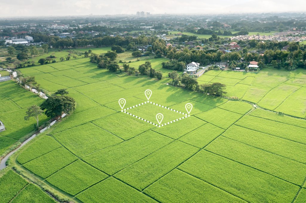
Choosing where to drill for water is one of the most important decisions in any borehole project. A poor drilling point can lead to low water yield, repeated drilling costs and delays that affect farms, estates, factories and construction sites.
A drone groundwater survey can help project teams assess large or difficult locations before bringing heavy drilling equipment to the site. By combining aerial mapping with ground-based geological or geophysical investigation, survey teams can understand the terrain more clearly and identify areas that may require closer examination.
This approach is especially useful on large farmland, undeveloped estates, mining locations and remote project sites where inspecting every section on foot would take more time.
What the Drone Actually Does During the Survey
A drone does not simply fly over a property and confirm that water is underground. Its main role is to collect detailed aerial information that supports wider groundwater investigation.
Depending on the equipment and survey method, the drone may help map:
- Surface elevation and slope
- Drainage channels and low-lying areas
- Rock outcrops and visible fractures
- Vegetation patterns
- Site boundaries and access routes
- Areas affected by erosion or flooding
- Suitable points for further ground testing
The survey team then compares this information with geological knowledge, nearby borehole records and measurements taken on the ground.
For example, aerial mapping may reveal a natural drainage line running across a large farm in Ogun State. That information may help the technical team decide where to carry out electrical resistivity testing rather than testing random parts of the land.
When Aerial Mapping Is More Practical Than Walking the Site
A small residential plot in Lagos may not require drone mapping. However, the situation is different when the land covers several hectares or includes difficult terrain.
A drone groundwater survey may be practical for:
- Large commercial farms
- New housing estates
- Industrial development sites
- Quarry and mining areas
- Remote communities
- Construction camps
- Solar farms and energy projects
In parts of Abuja, Plateau, Kaduna and the South-East, rocky terrain can make physical inspection slower. During the rainy season, muddy roads and waterlogged sections may also restrict vehicle and foot access.
The drone provides a wider view of the property, allowing the team to plan where field workers and instruments should be deployed.
The Survey Still Needs Ground Verification
One mistake is assuming that drone images alone can identify the exact depth and yield of groundwater. Aerial data is useful, but it should normally support—not replace—proper hydrogeological or geophysical assessment.
After reviewing the aerial map, the team may still need to carry out:
- Physical site inspection
- Electrical resistivity testing
- Geological assessment
- Comparison with nearby borehole information
- Marking of recommended drilling points
The reliability of the final recommendation depends on the quality of the combined investigation.
Property owners should ask the service provider what methods will be used after the drone flight and what the final report will contain.
Access and Logistics Can Affect the Survey Schedule
Even though a drone reduces some physical movement, the team still has to reach the site with survey equipment, batteries, laptops, cables and safety gear.
A remote farm outside Minna or a construction site near the outskirts of Ibadan may require a four-wheel-drive vehicle, especially when the access road is unpaved. Larger sites may also require overnight accommodation if the team cannot complete aerial mapping and ground testing in one day.
Before the visit, provide:
- Accurate coordinates or a clear landmark
- The estimated land size
- Photos of the access road
- Information about trees, power lines or tall structures
- Details of previous drilling attempts
- Permission to fly and inspect the property
Travo.ng can support field teams with vehicle hire, equipment delivery, hotel reservations and transport coordination where the project requires movement outside major city centres.
What to Ask Before Booking a Drone Survey
Confirm that the provider has experience with groundwater-related projects rather than general photography alone. A clear aerial image is useful, but the service should also produce practical information that supports drilling decisions.
Ask whether the quotation includes data processing, ground testing, mobilisation and a written report. You should also know how long the site work will take and whether the recommended drilling points will be physically marked.
Avoid choosing a provider only because the price is low. An incomplete survey can cost far more if drilling later fails.
Coordinate Your Survey Project With Travo.ng
A drone groundwater survey can make large-site assessment faster and more organised, particularly where terrain, distance or access makes traditional inspection difficult.
Travo.ng helps individuals and businesses coordinate field transport, equipment movement, vehicle hire, accommodation and other logistics required for groundwater and borehole projects across Nigeria.
With the aerial survey, ground investigation and field logistics properly planned, project owners can reduce guesswork and approach drilling with better site information.
How to find the best borehole location on your property
Begin with your required water use, property boundary and local hydrogeology. A suitable location must consider possible groundwater conditions alongside access, flood risk, contamination sources and the practicality of drilling and maintenance. The closest convenient spot to a building may not be the strongest technical choice.
A hydrogeologist should interpret nearby borehole records, geology and appropriate ground measurements. Electrical resistivity results can suggest subsurface contrasts, but interpretation is not unique: rock, clay and water conditions can produce overlapping responses. Ask what alternative explanations were considered.
| Evidence | Helps assess | Does not guarantee |
|---|---|---|
| Drone terrain map | Drainage, access and visible surface features | Underground water quantity |
| Ground geophysics | Subsurface-property contrasts | Exact yield or safe drinking water |
| Drilling and testing | Actual formation, yield and sampled water quality | Unlimited future supply |
Confirm yield and water quality after drilling
Agree the testing and handover requirements before mobilisation. The British Geological Survey groundwater guidance explains assessment of source yield. A pumping test and appropriate water-quality analysis address different questions; neither should be replaced by a reassuring aerial image.
Ask the qualified team how seasonal conditions, the proposed pumping demand and neighbouring uses affect the recommendation. Water suitable for one purpose may need treatment or a different assessment before another use. Record drilling logs, test results and recommended operating arrangements.
Prepare a groundwater survey enquiry
Send Travo the location, approximate demand, intended use, available borehole records and access constraints. Ask for the technical scope, ground verification, tests and equipment mobilisation to be itemised. Our aerial mapping guide explains terrain deliverables; the GIS services guide explains how different datasets are interpreted together.
Include any planned construction and known contamination concerns in the brief so the appropriate specialists can assess siting. A groundwater investigation reduces uncertainty; it cannot promise the exact drilling depth or a productive borehole before ground evidence is obtained.
