


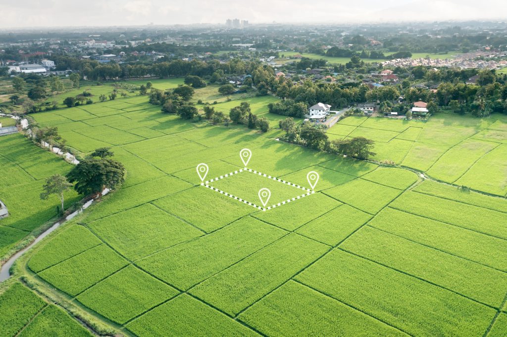
If you are looking for a drone survey company in Nigeria or Ghana, the most useful starting point is the decision your map must support. Designing drainage, checking earthworks, surveying a farm and screening a mining concession require different data. A sharp aerial photograph alone may not answer the question.
Travo Travel Services can help you scope an aerial survey enquiry and coordinate the project requirements. This guide explains what to request, how to compare proposals and which deliverables make the results usable by your engineer, geologist or GIS team.
Which aerial mapping service do you need?
| Requirement | Typical output | Question to ask |
|---|---|---|
| Visual site inspection | Georeferenced photographs and orthomosaic | Is the resolution suitable for the smallest feature I need to inspect? |
| 3D terrain mapping | Point cloud, surface model, contours | Does this represent roofs and vegetation, or the ground? |
| LiDAR survey services | Laser point cloud and classified terrain products | How will vegetation, missing ground returns and classification be checked? |
| Topographic design | Terrain levels, breaklines and survey drawings | What engineering accuracy and ground verification are included? |
| Progress and volume monitoring | Comparable dated models and volume report | Will repeat surveys use the same reference and measurement method? |
Orthomosaic mapping, DEMs and LiDAR explained
An orthomosaic joins corrected aerial images into a map that can be measured in the agreed coordinate system. It helps teams see access roads, buildings, visible excavation and crop patterns. Ask for the imagery date and coverage gaps: a map is a record of that survey, rather than a live view of the property.
A digital elevation model is an elevation dataset. A digital surface model includes visible objects such as trees and buildings; a terrain model aims to represent bare ground. Specify which you need. Designing drainage using canopy heights can lead to misleading conclusions.
LiDAR measures surfaces using laser returns. The USGS explains its use for three-dimensional mapping and terrain interpretation. It does not directly reveal underground gold or groundwater. Ground returns through vegetation depend on site conditions and acquisition quality, so a promise of perfect bare-earth mapping everywhere deserves scrutiny.
High resolution does not automatically mean survey accuracy
Ground sampling distance describes the size of an image pixel on the ground. Positional accuracy describes how close measured coordinates are to independently checked locations. They are different measures. A very detailed image can still be displaced if its reference or processing is wrong.
For high resolution aerial surveys, ask for the planned resolution, ground-control approach, independent checkpoints and an accuracy report. Clarify whether the quoted accuracy is horizontal, vertical or both, and whether it is measured or merely expected. Agree how areas with water, reflective surfaces, moving vegetation or poor texture will be handled.
A drone map also does not automatically settle a land boundary dispute or replace a legally recognised cadastral survey. Tell the provider if the purpose is engineering design, title documentation or evidence in a dispute so the appropriate qualified professionals and standards can be identified.
Permissions in Nigeria and Ghana
Commercial missions need country-specific compliance. Review the NCAA commercial RPAS certification guidance for Nigeria and the Ghana Civil Aviation Authority RPAS resources for Ghana. Ask the proposed operator to confirm the approvals applicable to your mission, aircraft, pilot and location.
Landowner permission, airspace restrictions, nearby airports, site security and weather can affect mobilisation. A Nigerian project approval should not be assumed to cover a Ghanaian project. Build approval and access tasks into the schedule rather than promising a flight date before they are checked.
What should the survey handover include?
- Final boundary, survey date and areas not captured.
- Coordinate reference system and vertical reference stated clearly.
- Requested orthomosaic, point cloud, terrain model and editable drawings.
- Ground-control and checkpoint report with limitations.
- Processing notes, file formats and data ownership arrangements.
- A review meeting explaining whether the data answers the agreed objective.
Check compatibility with your engineer’s or GIS consultant’s software before delivery. A PDF image may be convenient to read, but it is not a substitute for the underlying spatial files when designers need coordinates, elevations or analysis.
Request an aerial survey quote that can be compared
Provide a boundary file or marked map, site area, access conditions, desired outputs and intended use. State whether travel, ground survey, specialist interpretation and repeat visits should be included. Compare like-for-like deliverables rather than just a per-hectare figure.
For exploration projects, read our drone mineral exploration guide. For farm decisions, see precision agriculture in Nigeria. These explain why aerial mapping should be connected to field evidence.
Prepare your drone survey brief
Use this checklist to prepare your enquiry. Selections stay in this page only.
How Travo can assist
Bring the technical survey brief and the practical mobilisation requirements into one enquiry. Travo can discuss survey coordination alongside field-team travel, construction logistics and equipment transport. Ask for the proposed technical provider, responsibilities and exclusions to be confirmed in writing.
Common questions
Can a drone survey replace every ground survey?
No. Ground measurements, underground investigation and professional interpretation remain necessary where the decision requires them. Combine methods according to the question and accuracy required.
How quickly can a site be mapped?
The schedule depends on area, permissions, weather, access, sensor choice and processing. Ask for separate mobilisation, acquisition and delivery dates, including a contingency for reflight.
