


Before constructing an estate, factory, warehouse or access road, define what the engineer needs to decide. A foundation investigation, slope assessment and earthworks planning survey share site information but have different technical outputs. This guide helps a Nigerian project owner prepare the brief and compare proposals on scope rather than a generic “land survey” label.
Start with the development and existing information
Provide the site boundary, location, proposed use, preliminary building arrangement, anticipated loads if available and earlier investigation reports. Include the history of filling, excavation, flooding, mining or nearby construction where known. Tell the investigation team about utility records, access restrictions and visible signs of movement. Do not assume a flat-looking site has uniform ground.
Ask the responsible geotechnical or structural engineer which information is needed for the current design stage. A feasibility study may screen constraints; detailed foundation design normally needs a more specific investigation. The quotation should identify which decision the report supports and which further work may be required.
Foundation investigation services: what to discuss
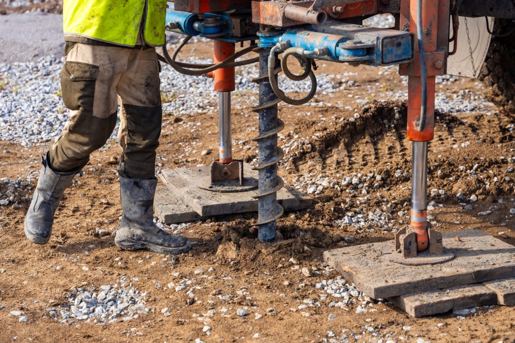
Ask about the proposed investigation locations, field methods, sampling, laboratory work and interpretation. The specialist should select the programme for the site and structure. Do not choose a standard number of boreholes from an advertisement without relating it to the footprint, variable ground conditions and design risk. Geophysics can help identify contrasts or target follow-up, but does not automatically supply every soil parameter needed for design.
Confirm who is responsible for the technical conclusions, what information is preliminary and whether the scope includes recommendations for further testing. If previous reports exist, check their locations, dates and intended use before reusing them for a changed design. A report for one plot or building should not be assumed to cover an entire estate.
Detecting sinkholes, cavities and unstable ground
Ground subsidence has different possible causes. The USGS overview of sinkholes and subsidence explains why subsurface processes matter. It does not diagnose a Nigerian property. A specialist should consider local geology, ground history, water conditions and observed movement before choosing an investigation method.
For suspected underground voids, see the related GPR and geophysical guidance. A potential anomaly needs interpretation and appropriate verification. Do not enter a cavity or drive heavy equipment across visibly distressed ground to inspect it. Obtain a competent site assessment and follow the responsible engineer’s access instructions. A negative scan should not be marketed as a universal stability certificate.
Slope stability and landslide risk assessment
A slope stability survey is more than measuring a slope angle. The investigation may need geological structure, material properties, groundwater, drainage, loading and evidence of past movement, alongside geometry. The USGS Landslide Hazards Program provides hazard context; the actual engineering assessment must be site-specific.
Agree monitoring points and escalation responsibilities if movement is suspected. Repeat aerial mapping can support change observation, but ground control, comparable acquisition and measurement uncertainty matter. A visually different surface is not automatically a measured displacement. An engineer should determine how observations relate to risk and action.
Earthworks planning surveys and terrain models
For cut-and-fill planning, request a terrain model suited to the surface the designer needs. A digital surface model can include trees and buildings; a ground model aims to represent terrain. USGS’s lidar and elevation-model explanation distinguishes point-cloud observations from derived elevation products. State the intended accuracy and reference system, not only the desired map resolution.
Earthworks quantities depend on agreed boundaries, existing and proposed surfaces and exclusions. They do not automatically establish the volume of saleable material or the number of trucks required. Loading, density assumptions and vehicle capacity are separate logistics inputs. Record assumptions so a later variation can be checked against the same basis.
| Workstream | Main question | Handover to request |
|---|---|---|
| Topographic or terrain mapping | What is the site geometry? | Referenced drawings, models and accuracy information. |
| Geotechnical investigation | How do ground conditions affect the design? | Field and test results with competent interpretation. |
| Geophysical investigation | Where are relevant subsurface contrasts? | Coverage, anomalies, uncertainty and verification recommendations. |
| Earthworks assessment | What changes between agreed surfaces? | Boundaries, calculations, assumptions and exclusions. |
Pre-construction enquiry checklist
Use this checklist to prepare your enquiry. Selections stay on this page only.
Coordinate site investigation with Travo
send Travo your enquiry with the location, area, proposed development and decision deadline. Ask for the technical provider’s scope and the transport or equipment support needed through the Travo service catalogue. See aerial mapping and LiDAR planning, Nigeria geophysical mobilisation and land and investment evidence checks. Confirm the competent engineer’s deliverables; logistics coordination does not constitute foundation approval or a guarantee of ground stability.
