


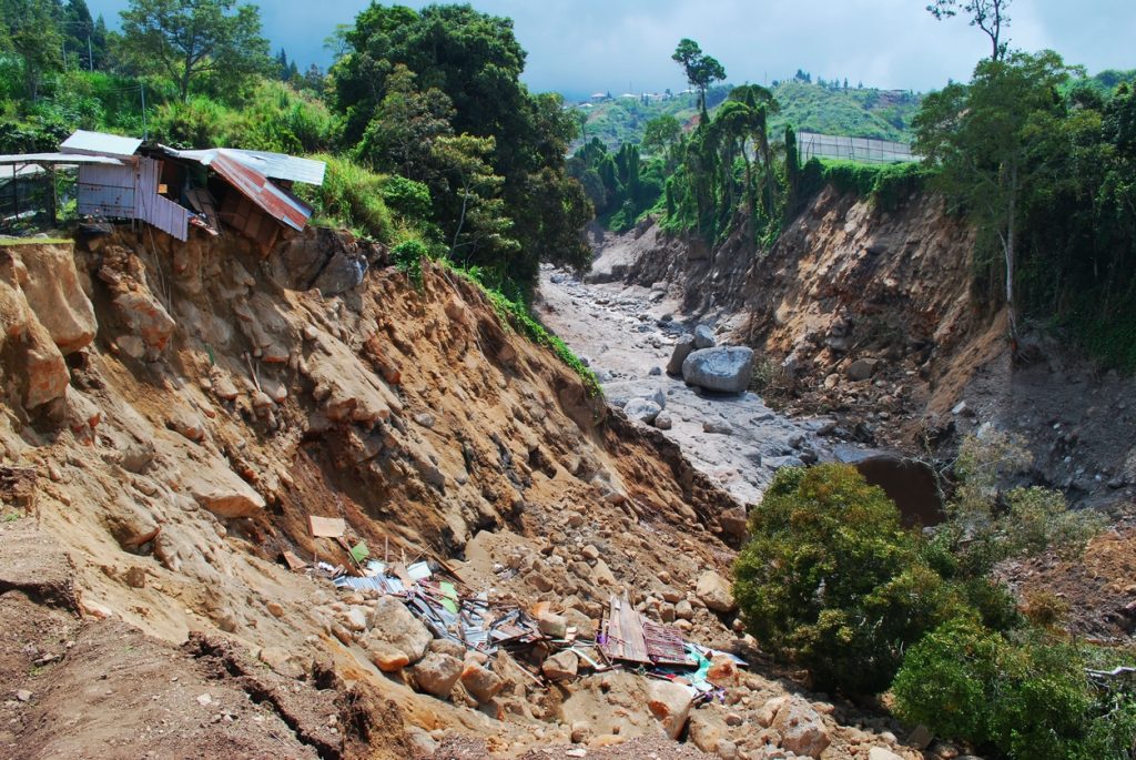
An environmental survey company may be asked to support a property purchase, mine operation, infrastructure project or restoration programme. The right scope depends on the site history, receptors, intended use and applicable requirements. This guide helps Nigerian clients define environmental risk assessment, baseline and monitoring work that can be reviewed and repeated.
Environmental baseline survey: establish the starting condition
A baseline records relevant conditions before a project or intervention, with a date and method. It may combine field observations, mapping, sampling and records review. Agree which environmental questions need evidence and where measurements will be taken. A snapshot after work has begun should not be described as proof of the undisturbed pre-project condition.
For the Nigerian environmental assessment process, start with the Federal Ministry of Environment’s Environmental Assessment Department and confirm the requirements for the actual project. A commercial survey report is one input to review, not automatic regulatory approval. Identify the competent professionals, authority interactions and report responsibilities in the contract.
Contaminated land assessment and land contamination surveys
Begin with site history, former uses, known incidents, existing records and a competent walkover where safe. The investigation should identify potential sources, pathways and receptors and then select appropriate testing. A dark patch in an image does not identify a chemical or establish its concentration. Sampling and laboratory analysis may be needed to investigate the actual contaminants of concern.
Agree sampling locations, analytes, laboratory methods, detection limits and quality controls with the specialist. Preserve sample identity and custody. A “clean” result for one substance at one location does not prove the whole property is suitable for every use. Ask how the conclusions relate to the proposed land use and what remains uncertain.
Radiation and uranium contamination survey services
Radiological questions require appropriate instruments, calibration, sampling and competent interpretation. A visible-light or ordinary thermal drone cannot identify uranium contamination. The Nigerian Nuclear Regulatory Authority’s radiological safety department describes its oversight role; confirm the authorisations relevant to the proposed practice and provider.
The IAEA guidance on soil and vegetation sampling for radiological monitoring explains the importance of a programme designed for the source and environment. A radiation count or radiometric anomaly is not automatically a diagnosis of exposure risk or a specific contaminant. Ask who will interpret results and determine further action. Do not collect unknown suspected radioactive material yourself for an informal test.
Mine pollution and land restoration monitoring
Combine the spatial extent of disturbance with the water, soil or other measurements relevant to the risk. Define the restoration objectives and indicators before monitoring begins. Repeat imagery can support an evidence trail for drainage, vegetation cover and disturbed area; it does not establish every ecological or chemical outcome. See environmental evidence in land and mining investment for due-diligence questions.
For an existing or abandoned mine, identify safe access and the responsible technical team before fieldwork. State whether the task is mapping, contamination assessment, rehabilitation evaluation or closure support. The different workstreams should have explicit deliverables and competent sign-off rather than being merged into one unqualified “site safe” conclusion.
Wetlands, erosion, coasts and forests
Wetland mapping needs a definition, appropriate seasonal context and verification of ambiguous areas. Coastal erosion monitoring needs a consistent shoreline indicator and comparable acquisition conditions; tide and water level can affect apparent change. For erosion on land, agree the features, measurement approach and uncertainty before interpreting a small difference as a real loss.
Forest and deforestation monitoring should state the forest definition, baseline date, imagery sources and classification accuracy. Distinguish tree-cover change from the legal status or cause of an activity. Ecosystem monitoring may need species and habitat fieldwork in addition to remote sensing. The GIS and remote-sensing guide explains why data validation matters.
Carbon project monitoring, ESG and verification mapping
Carbon-project maps can support boundaries, land-cover analysis, field sampling design and monitoring records. They do not create credits by themselves. Verra’s programme explanation distinguishes project monitoring from verification by an approved independent validation/verification body. The applicable methodology, baseline, accounting and review requirements still apply.
For ESG reporting, connect each mapped indicator to a defined reporting boundary, period and evidence source. Keep assumptions, exclusions and uncertainty available for review. A dashboard should not claim verified emission reductions or complete environmental compliance solely because it displays satellite data. Ask what evidence an auditor or regulator will actually need.
Environmental survey brief
Use this checklist to prepare your enquiry. Selections stay on this page only.
Discuss environmental monitoring support with Travo
send Travo your enquiry with the site, history, intended use and required decision. Ask Travo to confirm the technical provider, specialist testing, report scope and field logistics. The Travo service catalogue can support mobilisation and related arrangements. Confirm whether the enquiry covers mapping, sampling, interpretation or regulatory submissions; no one image or general survey fee establishes all four.
Related survey and planning guides
- Mine and Quarry Monitoring in Nigeria: Drone Surveys, Stockpile Volumes and Tailings Risk
- Land Suitability and Site Selection in Nigeria: Due Diligence for Farms, Estates, Factories and Logistics Hubs
For authorised response support, see security and thermal drones for search, rescue and disaster mapping.
